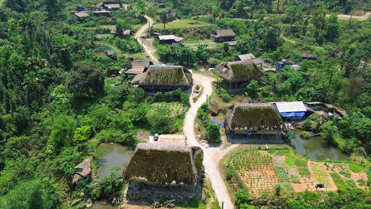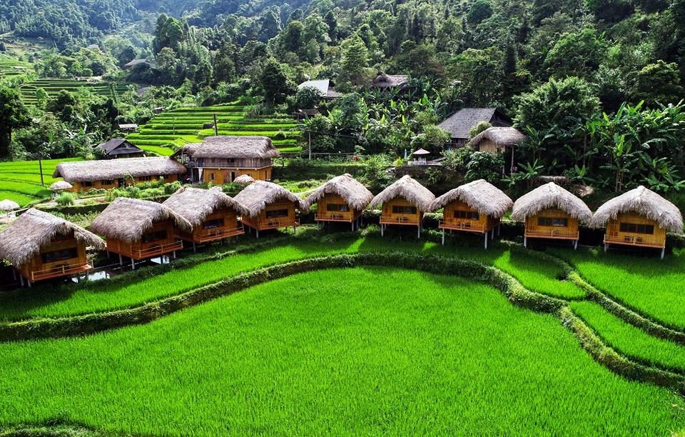
Ha Giang trekking is very much possible, and it shows you a different Ha Giang from the one the motorbike Loop does. The best multi-day route starts on foot in Ha Giang city and covers about 47 km in four days, through Dao villages, ancient Shan Tuyet tea trees, moss-roofed stilt houses and rice terraces, ending with a swim at a waterfall. You need moderate fitness for 10 to 16 km a day, and no border permit.
We run this village trek from our own hostel in Ha Giang city, so everything below comes from a route we walk with guests, not from a map. In this guide you will find where Ha Giang trekking actually goes, how hard each day is, when to come, what it costs, and how it compares with riding the Loop, so you can decide whether to walk, ride, or do both.
Is Ha Giang trekking worth it instead of the Loop?
It depends on what you came for. The Ha Giang Loop is a road journey: four great passes, the grey limestone of the Dong Van plateau and long days in the saddle. Ha Giang trekking is slow travel: green valleys under the Tay Con Linh range, village paths no vehicle can use, and evenings with the families who farm them. Most travellers never see this side because it sits just south and west of the city, away from the Loop road.
| Village trek (4 days) | Ha Giang Loop (3–4 days) | |
|---|---|---|
| How you travel | On foot, about 47 km in total | Motorbike or car, roughly 350 km |
| Landscape | Green valleys, tea hills, rice terraces | Stone plateau, mountain passes, canyons |
| People you meet | Dao and Tay village families | Hmong, Lo Lo and Tay communities along the road |
| Border permit | Not needed | Needed (included in our tour prices) |
| Best for | Walkers, slow travellers, people who don’t ride | Riders and first-time visitors who want the big views |
If you only have three days and have never been to Ha Giang, ride the Loop first. If you have a week, or you already know the road, Ha Giang trekking is the best way to add depth. Our Ha Giang Loop itinerary guide sets out the riding days, so you can see how the two fit together.
Where does the Ha Giang trekking route go?
Our Ha Giang trekking route makes a loop on foot from Ali Hostel. It climbs into the three highland villages of the former Phuong Do commune, crosses to Xa Phin under the Tay Con Linh range, then drops back through the valleys to Tha Village and Waterfall No. 6. You walk out of the hostel door on day 1 and walk back in on day 4, so there is no transfer to arrange and your main luggage stays with us.
| Day | Route | On foot | Overnight |
|---|---|---|---|
| 1 | Ha Giang city → Ha Thanh → Na Thac → Khuoi My | 11 km | Homestay, Khuoi My (private room) |
| 2 | Khuoi My → Lung Vai tea trees → Xa Phin terraces | 10 km | Homestay, Xa Phin (private room) |
| 3 | Xa Phin → Na Mau → Phuong Tien | 16 km | Ha Giang Ecolodge, Phuong Tien |
| 4 | Phuong Tien → Tha Village → Waterfall No. 6 → Ali Hostel | 10 km | Trek ends in Ha Giang city |
What will you see on a Ha Giang trekking trip, day by day?
Day 1: Tay stilt houses and the first Dao villages
The first village on the Ha Giang trekking route is Ha Thanh, a Tay settlement about 6 km from the city centre, with palm-thatched stilt houses and rice paddies. It has been a recognised community-based tourism village since December 2021. From there the path leaves the road and climbs to Na Thac and Khuoi My.
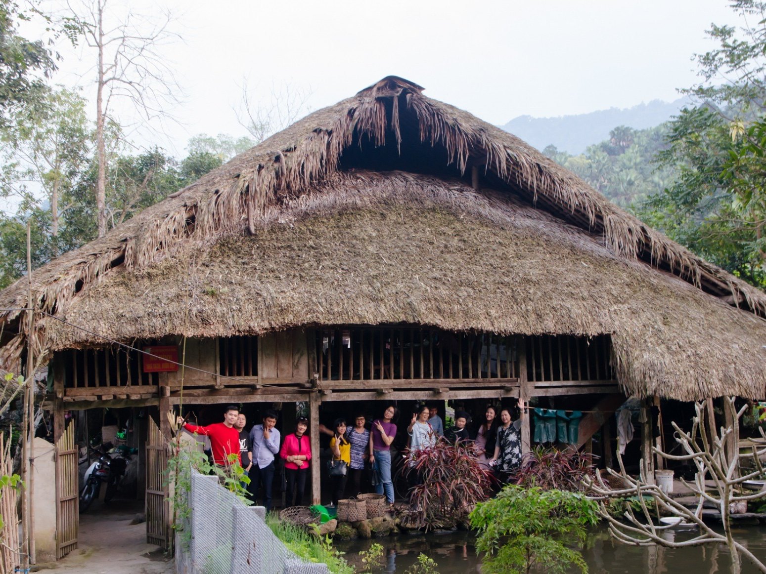
Na Thac, Khuoi My and Lung Vai are the three highland villages under the Tay Con Linh range, where Dao families have lived in palm-thatched stilt houses for more than 300 years, according to the provincial newspaper’s profile of the three villages. Together they hold around 90 hectares of rice terraces. Khuoi My alone has 214 households, all of them Dao. You sleep here on night one, in a private room with a host family, and share a home-cooked dinner.
Day 2: Ancient tea trees in Lung Vai and the Xa Phin terraces
Day 2 is the one guests talk about afterwards. Lung Vai is a tea village of long-dress Dao families, about 13 km from the city. Its Shan Tuyet tea grows between 700 and 1,500 metres above sea level, on trees more than three metres tall and as thick as a person’s embrace. Each tree gives 10 to 15 kg of fresh buds per picking, three pickings a year, as the provincial newspaper reported from Lung Vai. If the tea story hooks you, read our guide to Ha Giang tea and the Cao Bo forests.
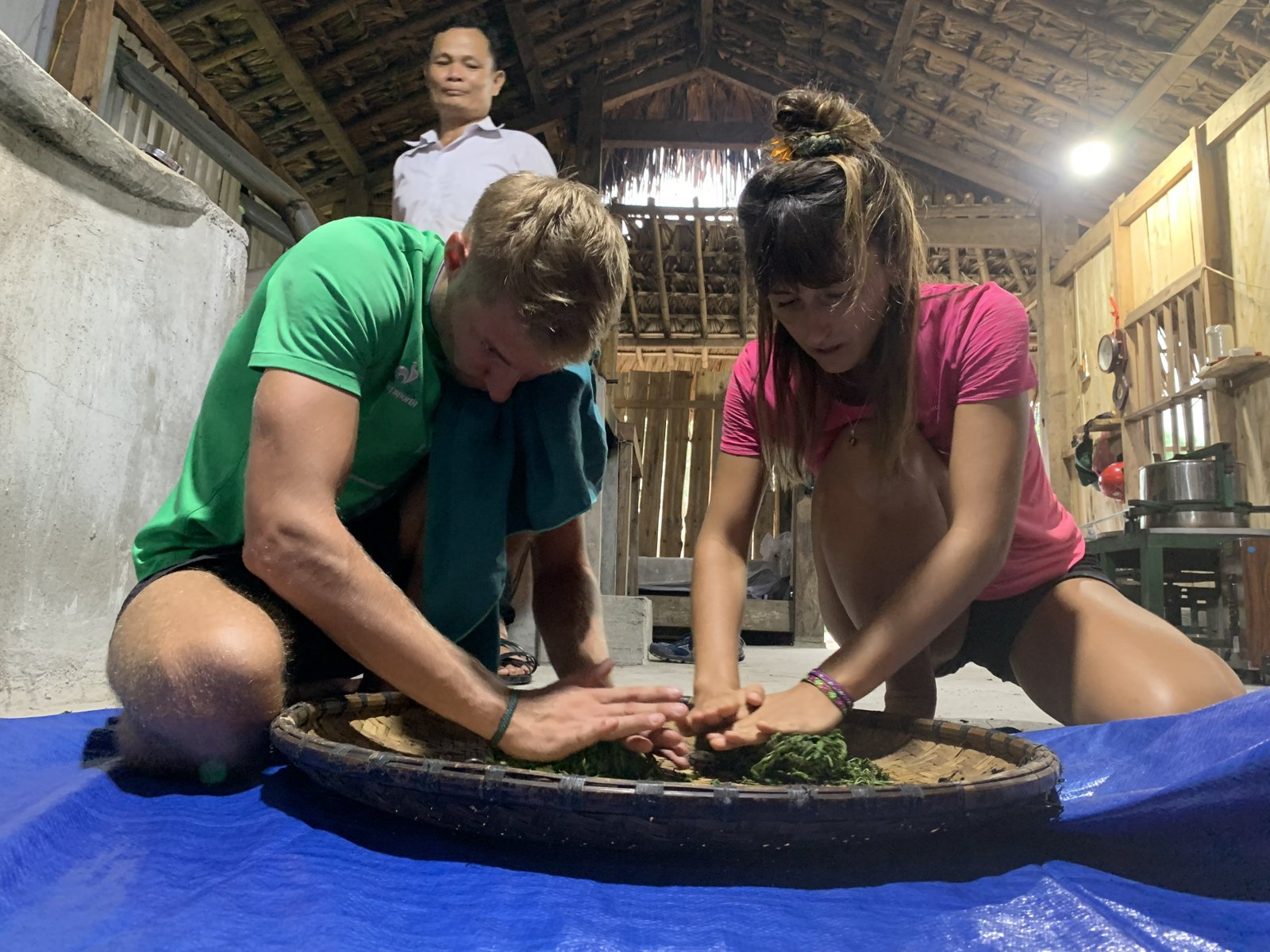
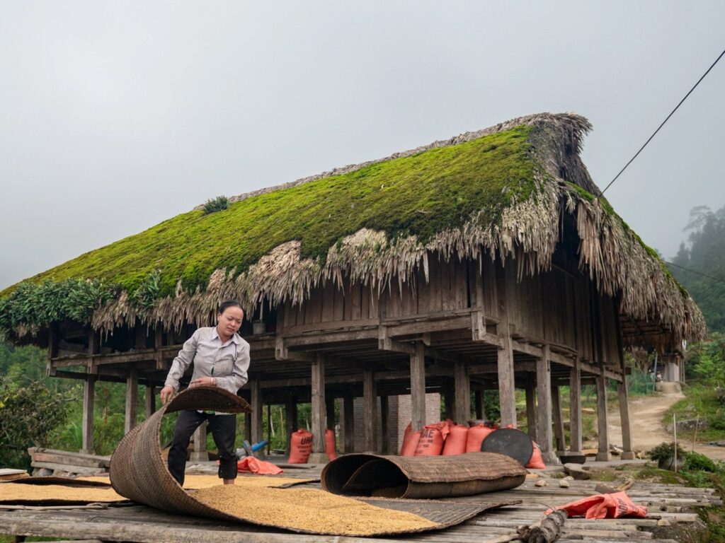
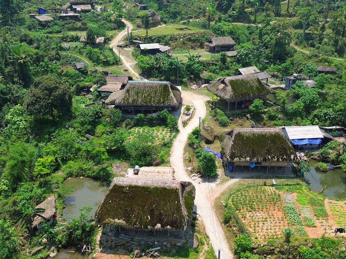
In the afternoon you walk into Xa Phin, a village of about fifty Dao households at more than 1,000 metres. Its stilt houses wear thick green moss on their palm roofs, because the slopes here are wet and humid for much of the year. We wrote a full guide to Xa Phin village if you want the background before you go. Night two is in a homestay here, again in a private room.
Day 3: The long walk to Phuong Tien
This is the longest day of Ha Giang trekking on our route: 16 km, with an earlier start. The path goes out of Xa Phin to Na Mau, another village of moss-roofed houses at the foot of Tay Con Linh, then down to Phuong Tien. You arrive in the late afternoon at Ha Giang Ecolodge, where the reward is a proper bed and a hot shower after three days on the trail.
Day 4: Tha Village and a swim at Waterfall No. 6
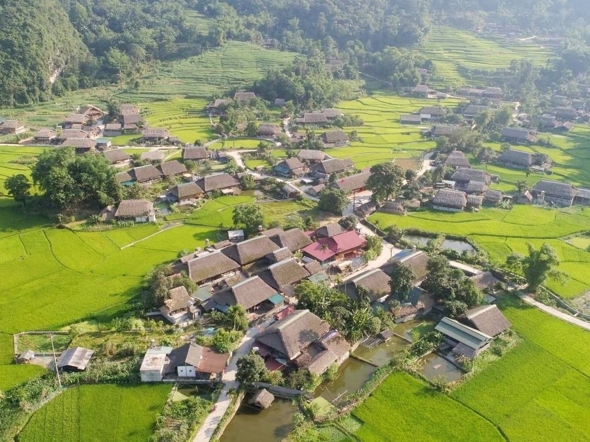
The last morning brings you to Tha Village, a Tay village of more than a hundred stilt houses among rice fields, most still built in the traditional style. In January 2025 its homestay cluster was one of five Vietnamese winners of the ASEAN Homestay Award. Our Tha Village guide has more on the village if you want to come back for a night.
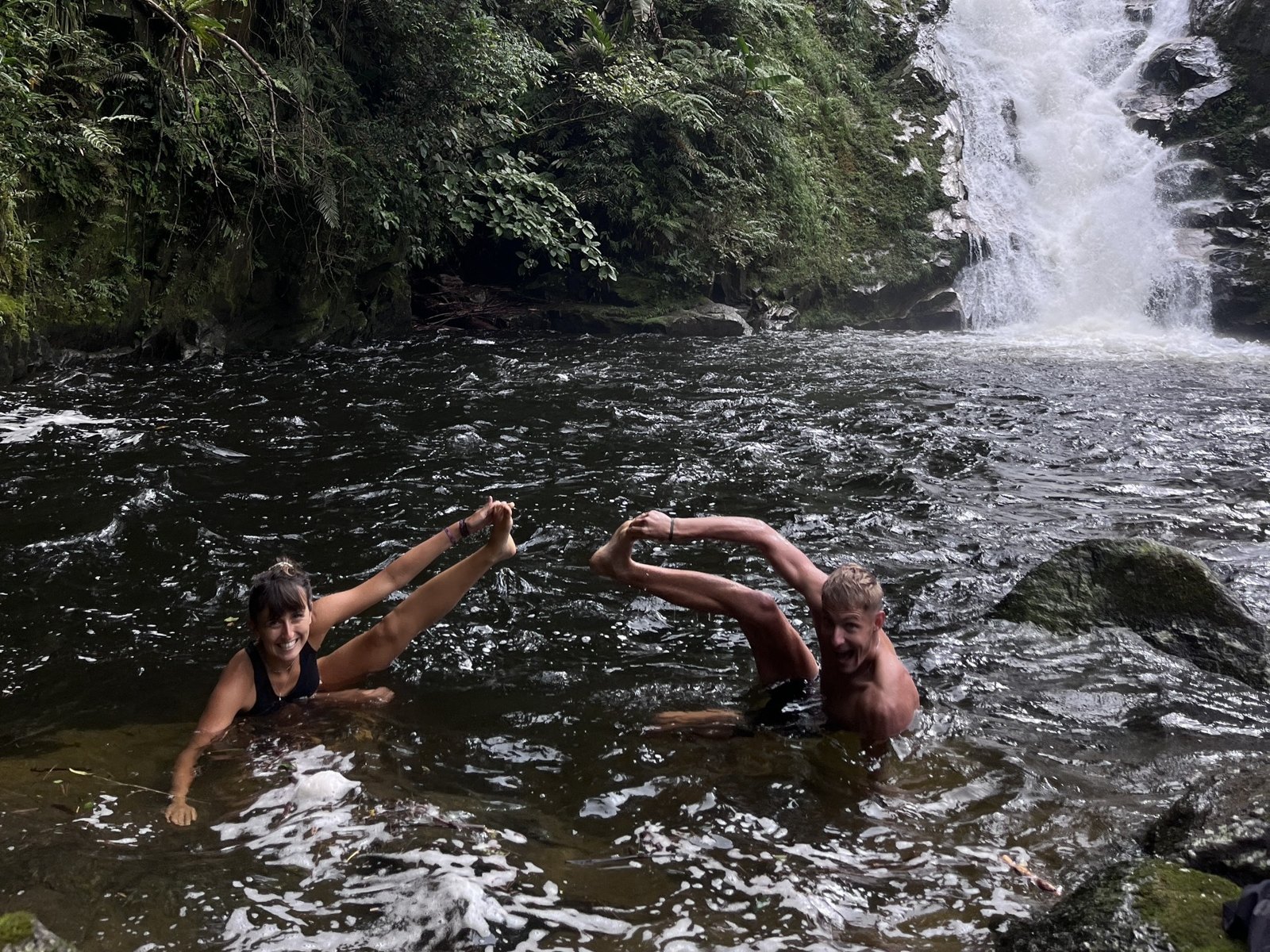
At noon you reach Waterfall No. 6, near Ha Thanh. It is not a big waterfall, but the water is clear, clean and cold, and after four days of walking the swim feels earned. Lunch is by the water, then you follow the path back to Ali Hostel. No vehicle from start to finish.
How hard is Ha Giang trekking?
We rate this Ha Giang trekking route as moderate, with one challenging day. You should be comfortable walking five to seven hours a day on uneven village paths, with climbs and descents, several days in a row. Nothing is technical and you never need ropes, but the paths are farm tracks, not graded hiking trails.
- Daily distance: 10 to 16 km, about 47 km over four days.
- Hardest day: day 3, 16 km from Xa Phin to Phuong Tien.
- What you carry: one small backpack for three nights. A local porter-guide carries the picnic lunch and leads the way.
- Weather plan: in heavy rain the guide may shorten or reroute a section for safety.
Families should talk to us before booking: 10 to 16 km a day is a lot for young legs. If walking that far is not for you, our guide to the number of days on the Loop covers the riding options instead.
When is the best time for Ha Giang trekking?
The best time for Ha Giang trekking is September to May, when it is drier and cooler for walking. June to August is lush and green, but rainy, and the paths get slippery. Within the dry months, each season changes what you see:
- Mid-September to mid-October: the rice terraces turn gold around Khuoi My and Xa Phin, with harvest in mid-October. See our Ha Giang rice season guide for timing.
- October to April: the moss on the Xa Phin roofs is at its thickest and greenest.
- December to March: villagers around Na Thac plant mustard flowers that turn the hillsides yellow. Nights are cold, so bring a warm layer.
- May to June: water fills the terraces and they shine like mirrors, though rain becomes more frequent.
For month-by-month temperatures and rainfall, check our Ha Giang weather by month page before you pick dates.
How much does a Ha Giang trekking tour cost?
Our Ha Giang Village Trek, 4 days costs 7,979,000 VND per person (about $307) for two guests on a private trek. VAT is already in the price. Groups of three or more share the guide and porter-guide, so the price per person goes down; message us for a quote.
What the price includes:
- 2 nights in local homestays with private rooms (Khuoi My and Xa Phin) and 1 night at Ha Giang Ecolodge
- 4 breakfasts, 4 lunches and 3 dinners
- 1.5 litres of drinking water per person per day
- An English-speaking trekking guide, plus a local porter-guide (1 per 4 guests)
- Entrance fees on the route, and travel insurance for every guest (up to 50,000,000 VND per incident)
Not included: transport to and from Ha Giang, drinks other than water, and tips. To book, you pay a deposit of 500,000 VND per guest and the rest before departure; bank transfer has no fee. The full terms are on our booking and refund policy page. Most guests arrive on the night bus; our Hanoi to Ha Giang bus guide compares the classes and fares.
What should you pack for Ha Giang trekking?
You carry your own things for three nights, so pack light. One small backpack is enough, and the rest of your luggage can stay at Ali Hostel while you walk.
- Broken-in trekking shoes with good grip, because village paths can be muddy
- Swimwear for Waterfall No. 6
- A rain jacket and a warm layer for evenings, which are cool at 1,000 metres
- Sunscreen, a hat and sunglasses
- Cash in VND, since there are no ATMs in the villages, and a power bank
- Personal medication
Our full packing list was written for the Loop, but the clothing advice works just as well for Ha Giang trekking.
Do you need a permit or a guide to trek in Ha Giang?
You do not need a border permit for Ha Giang trekking on this route; it stays outside the border-permit area. A guide is a different question. The paths between Khuoi My, Lung Vai and Xa Phin are farm tracks with no signposts, and most host families speak Dao or Tay rather than English. A local porter-guide who knows the paths, plus an English-speaking guide who can translate at the dinner table, is what turns a walk into a real conversation with the people who live here.
Can you combine Ha Giang trekking with the Loop?
Yes, and it is the combination we recommend most to travellers with a week. Because the trek starts and ends at Ali Hostel, you can come back on day 4, sleep, and set off on a Loop tour the next morning. You get the green, quiet valleys on foot and the stone plateau by bike, two sides of the same province. Vegetarian meals and other dietary needs can be arranged on both if you tell us when you book.
Ha Giang trekking: frequently asked questions
Can I do Ha Giang trekking without a tour?
You can walk around the villages on your own, but a multi-day route is hard to do alone. The paths are unmarked, homestays in small villages are not always bookable online, and few hosts speak English. A guide also handles the logistics of meals and rooms for you.
How many days do I need for Ha Giang trekking?
Our route takes four days and three nights. That is the right length to reach Xa Phin and come back on foot without rushing, at 10 to 16 km a day.
Is Ha Giang trekking suitable for beginners?
Yes, if you are reasonably fit. You don’t need hiking experience, but you do need to be comfortable walking five to seven hours a day on uneven ground for several days.
Where do I sleep on a Ha Giang trekking tour?
Two nights in Dao family homestays, in private rooms, at Khuoi My and Xa Phin, and one night at Ha Giang Ecolodge in Phuong Tien. You eat dinner with your hosts on the homestay nights.
What is the difference between Ha Giang trekking and the Ma Pi Leng trek?
The village trek is a four-day walk in the green valleys close to Ha Giang city. Trekking Ma Pi Leng Pass is a shorter walk on the stone plateau in the far north, usually done as part of a Loop trip.
Ready to walk Ha Giang?
Ha Giang trekking is for travellers who want to slow down: to drink tea from trees older than anyone in the village, sleep under a moss roof and finish with a cold swim. Tell us your dates and group size and we will check homestay availability and send the day-by-day plan.
WhatsApp / Zalo: (+84) 787 652 333 · Email: info@hagiangalitravel.com · Web: hagiangalitravel.com
See more: